Saturday, March 31, 2018

March 31, 2018

Bipolar Weather

Current Conditions:

Temperature: 20 °F
Dew Point: 6 °F
Winds: W 15 mph
Pressure: 1023.0 mb
Visibility: 10 miles

Today started off mild with a temperature of 27 ° and winds N at 14 mph. The dew point was also 27 °F which means the dew point depression was 0 and the air was completely saturated. Early this morning it was still snowing and the snow was heavy and wet. By mid-morning there was light snow and fog in the Eau Claire area. This is the result of a low pressure system moving through from the north. What a great way to welcome in April. And no, this was unfortunately not an April fool's joke. Later in the day the snow stopped and the sun came out for a few hours. Figure 1 shows the temperature, winds, and pressure as the day progressed.
Figure 1. Weather overview for March 31, 2018.
The top graph shows the dew point and temperature being the same early in the day and by the end of the day they had diverged and lowered, a consequence of the low pressure system moving south and a high pressure dome moving in. The barometric pressure also tracks the low pressure system with a low around 6:00 to 7:00 AM. The wind speed increased after the low pressure system moves over because of the force of the system moving away. Wind direction also switches with winds now coming out of the north bringing the cooler temperatures. Figure 2 shows the cooler temperatures that have settled over Wisconsin following the low pressure system.
Figure 2. Temperature map of the United States on March 31, 2018.

Previous Prediction

Yesterday I predicted snow and overcast skies which did happen this morning. However the system moved south quickly and skies were clear later in the day.

Prediction

For tomorrow I predict the high pressure system will stay in the area (figure 3) and temperatures will be lower, in the 30s with partly cloudy skies.
Figure 3. Surface map of the United States on March 31, 2018.

Although tomorrow will be nice, another snow storm is brewing and could hit on Monday leaving another 1-3 inches of snow. Oh how wonderful a Wisconsin spring is...

Friday, March 30, 2018

March 30, 2018

Incoming Snow

Current Conditions

Temperature: 41 °F
Dew Point: 27 °F
Winds: W 16 mph
Pressure: 1020.0 mb
Visibility: 10 miles

Today's weather has been mostly uneventful. The day started off with partly cloudy skies and a light breeze with temperatures in the mid 20s. By the afternoon winds had picked up and the temperature climbed into the upper 30s. The current temperature is the high for today. Figure 1 shows the change in temperature, dew point, and wind speed throughout the day.
Figure 1. Daily Weather History Graph for March 30, 2018.
The current overcast skies and winter weather advisory can be attributed to the incoming low pressure system bringing a chance of snow to the area (figure 2).
Figure 2. Surface map of the United States for March 30, 2018.
The system should hit Eau Claire sometime tomorrow. Along the east coast the cold front and accompanying low pressure systems have finally made their way to the coast but are still stubbornly holding out over land. This continues the rainy trend in the area.

Previous Prediction

The temperature was similar to yesterday, however I predicted the skies would be clear like yesterday and this was not the case. The cold front moved into Wisconsin faster than anticipated so skies were overcast most of the day.

Prediction

Tomorrow should be an interesting day with the low pressure system sitting right over the Eau Claire area. There will be some snow and a wintry mix throughout the day as the low pressure system moves farther south. Temperatures should be a bit cooler with the increased cloud cover and precipitation.

Thursday, March 29, 2018

March 29, 2018

Sunny and Clear

Current Conditions

Temperature: 38 °F
Dew Point: 16 °F
Winds: N 16 mph
Pressure: 1018.6 mb
Visibility: 10 miles

This morning the temperature was a mild 25 °F with winds NNW at 12 mph. Skies were sunny and have continued to be so for the entire day. By the afternoon the temperature rose to 33 °F with winds WNW at 8 mph. The temperature right now is close to the projected high for the day as well. The clear skies and uneventful weather is due to a high pressure dome sitting over Wisconsin shown in figure 1.
Figure 1. Surface map of the United States depicting a high pressure dome over Wisconsin.
The surface map also shows a cold front with several low pressure systems moving through the southeastern and eastern United States bringing flashfloods and rain and thunderstorms. The western portion of the United States is also in a high pressure system so skies are clear and the weather is calm. The temperature map in figure 2 shows warm temperatures in the south and progressively cooler temperatures in the north that mimic the location of the high pressure system moving in from Canada.
Figure 2. Temperature map of the United States on March 29, 2018.
Finally, the wind map in figure 3 validates the current northerly wind direction and one can see the fronts moving through the southeastern United States as lines where winds are moving towards.
Figure 3. Wind map of the United States. The two cold fronts in the southeastern United States are visible as dark blue lines amidst the green wind arrows.

Previous Prediction

My previous forecast was correct, temperatures are cooler today due to the high pressure system, but the skies are clear and not partly cloudy.

Prediction 

For tomorrow, I predict conditions much like today and the high pressure system staying in the area causing these similar conditions. By Saturday however there is a chance of snow from a system moving in from the north that is shown in figure 4.
Figure 4. Prediction forecast map for March 30, 2018. A snow system is moving in from the north and will likely hit Eau Claire on March 31, 2018.

Wednesday, March 28, 2018

March 28, 2018

Sunny with Some Clouds

Current Conditions

Temperature: 53 °F
Dew Point: 27 °F
Winds: WSW 12 mph
Pressure: 1010.8 mb
Visibility: 10 miles

Today was the best day in terms of temperature this week. The high was 54 °F, close to the current temperature. Skies were clear until around 4:00 PM today when some wispy cirrus clouds rolled in. This morning the temperature was 24 °F with a dew point of 23 °F and 5 mile visibility. Eau Claire and surrounding counties were in a freezing fog advisory for the morning but the fog lifted by mid-morning as temperatures rose. This afternoon not much had changed but the winds picked us to 14 miles out of the south. Right now Eau Claire is caught between two frontal systems as shown in figure 1.
Figure 1. Surface map of the United States. An occluded front lies to the southeast of Wisconsin and a cold front sits to the northwest.
The system to the north could be bringing some snow this weekend but we'll have to wait and see.
In the water vapor satellite (figure 2) one can also see the large amounts of moisture in the southeastern United States correlating to the occluded front dumping large amounts of precipitation in the region.
Figure 2. Water vapor satellite image of the United States. A large swath of moisture is covering the southeastern United States.

Previous Prediction

My prediction from yesterday was correct, the temperature rose due to the incoming low pressure system (and southerly winds) but the cloud cover was a bit less than yesterday.

Prediction

For tomorrow I predict cooler temperatures as a high pressure dome moves into the area. Skies will be partly cloudy much like they are now.

Tuesday, March 27, 2018

March 27, 2018

A Fair March Day

Current Conditions

Temperature: 33 °F
Dew Point: 28 °F
Winds: SW 4 mph
Pressure: 1018.3 mb
Visibility: 8 miles

Today was uneventful in terms of weather which is due to the high pressure dome sitting over Wisconsin and other portions of the Midwest. The temperature this morning was 34 °F with winds WNW at 10 mph and overcast skies. By the afternoon the temperature had climbed a whopping 1 °F with winds W 13 mph. The high today was 41 °F but dropped again to the current  temperature soon after nightfall.

The surface map for today shows the high pressure dome over Wisconsin and a low pressure system coming down from Canada (figure 1).
Figure 1. Surface map of the United States. A low pressure system is moving down from Canada and a cold front moving through the southeast is causing heavy rain events.
One can also see the cold front moving through the southeastern United States.
The wind map for today in figure 2 shows the same phenomena.
Figure 2. Wind map of the United States. Note the nor'easter off the east coast. The low pressure system in Canada can be located due to the counterclockwise wind rotations. The line between wind directions in the southeast shows the cold front in the area.
For world weather news, a snow storm in Eastern Europe dumped orange snow because the storm traveled through the Sahara Desert and picked up dust from the area. The full story can be read here.

Previous Prediction

Yesterday I predicted that temperatures would be in the 40s with overcast skies. This was mostly true but the skies did clear up later in the evening.

Prediction

Tomorrow I predict that the weather will be much the same as it was today with sky cover but the temperature will be warmer due to the low pressure system moving in from the northwest.

March 26, 2018

 Late Night Rain

Current Conditions

Temperature: 37 °F
Dew Point: 20 °F
Winds: SE 10 mph
Pressure: 1019.0 mb
Visibility: 10 miles

Today started off pretty mild with a temperature of 31 °F and winds E at 8 mph. The dew point was 20 °F and skies were partly sunny. As the day progressed the sky become overcast and the pressure continued to drop as a low pressure system rolled through causing some light rain later in the evening. the rain did stop by about 10:30 PM, so accumulations were low.The overall conditions for today are outlined in the graph in figure 1.
Figure 1. Weather conditions for March 26, 2018. The barometric pressure dropped as the day progressed indicating the approaching low pressure system.
In the southeastern United States, a storm system moving in from the Gulf and traveling southeast will unleash some heavy rains from Texas to Tennessee. The story states that some areas may reach or surpass their normal monthly rainfall for March in just a few days. This is a continuation of the cool, wet weather this region has been receiving the past couple weeks. According to a local resident I talked with last week, this spring has been cold and rain compared to what the weather is normally like in Tennessee. The projected path of the low pressure system is shown in figure 2.
Figure 2. Projected path of the low pressure system moving in from the Gulf of Mexico.

Prediction

Since I was away on spring break, I do not have a previous prediction for today. However, for tomorrow I predict mild temperatures in the 40s with mostly overcast skies due to the high pressure system moving into the Wisconsin area.

Monday, March 26, 2018

Spring Break: March 15-25, 2018

Colder than Expected

Cincinnati, OH

On March 15th the geography 368 class traveled down to Cincinnati, Ohio for one day of the trip. The weather was mild the night we arrived, but the following day was chilly with temperatures around 20 °F the morning of the 16th. The high that day was only 44 °F (figure 1).

Figure 1. Cincinnati skyline the night of March 16.

Chattanooga, TN

The next day was a travel day down to Chattanooga, Tennessee. Along the way we stopped in Nashville for lunch. The weather was great! Skies were clear with lots of sun and a temperature around 76 °F! Unfortunately, this would be the warmest day of the entire trip. On Sunday, March 18 the temperature had dropped to the upper 60s with partly cloudy skies. Winds were minimal so it was still enjoyable to be outside. The next day was our full day outside visiting Civil War sites (figure 2). The temperature was still in the upper 60s, but skies were overcast and it rained on and off the entire day. That evening a strong low pressure system from the northwest rolled through bringing thunderstorms and quite a bit of rain.
Figure 2. Civil War site during a rain event.
On Tuesday March 20 the weather was a bit cooler, only reaching lower 60s with overcast skies. The morning was relatively nice but by evening a storm system was approaching bringing light rains overnight. Wednesday March 21 was chilly once again with temperatures in the lower 20s in the morning and only reaching mid 40s by the afternoon. The group spent time outside touring the Tennessee Valley Authority (TVA), including a dam site. The winds were strong, particularly on the top of the dam (figure 3).
Figure 3. Dam on the Tennessee River operated by the TVA.

Knoxville, TN

Thursday the group traveled to Knoxville to meet with Derek Alderman and tour the geography department at the University of Tennessee Knoxville. The weather was once again chilly, but by the afternoon temperatures were mild, and the sun was shining. Friday we went to Smokey Mountain National Park and hiked for the day. Skies were partly cloudy turning to overcast but the temperature was in the mid 40s, perfect for a hike. It got a little chilly in the higher elevations but overall a good day (figure 4).
Figure 4. Skyline in the Smokey Mountains.
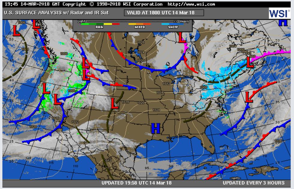
On Saturday, March 24 the group drove back to good old Eau Claire, WI. Because of a low pressure front moving towards us, we had to re-route and travel westward towards Nashville and then up to Chicago before finally making it back to Eau Claire. The total drive time was around 17 hours. Part of the issue was driving through the storm, which coated the interstate in ice (figure 5).
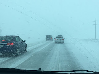
Figure 5. Winter storm in Illinois.
The group eventually made it back safe and sound around 11:30 PM.

Eau Claire, WI

Sunday in Eau Claire was much warmer than down south surprisingly with a temperature in the upper 40s, sunshine, and a light breeze.

Wednesday, March 14, 2018

March 14, 2018

Another Sunny Day

Current Conditions

Temperature: 39 °F
Dew Point: 23 °F
Winds: 10 mph
Pressure: 1010.8 mb
Visibility: 10 miles

Today was very similar to yesterday. Skies were clear and the temperature reached the high 30s. This morning the temperature was 17 °F with winds SSW at 7 mph. By this afternoon winds had shifted to the west at 10 mph. This wind shift was predicted yesterday with the stationary front moving eastward towards the area. The weather remains uneventful in terms of storms because of the high pressure dome that continues to dominate over the Midwest (figure 1).
Figure 1. Surface map of the United States.
From the surface map one can see the high pressure dome over the Midwest but low pressure systems dominating the east and west coasts. The east coast has been high with the third nor'easter in two weeks resulting in feet of snow. Some tendrils from the current low pressure system are making their way into the Ohio/Indiana region but for the most part the storm is sticking around the coast. The west coast is also receiving some precipitation but in much less amounts. This is shown in figure 2.
Figure 2. Map showing precipitation amounts in the United States.
The green areas denote higher precipitation amounts. The largest green areas are on the east coast in the center of the nor'easter currently plowing through the region. 

Previous Prediction

My prediction from yesterday was correct. Winds started in the southwest and transitioned to westerly winds which resulted in warmer temperatures today.

Prediction

For tomorrow, I predict temperatures similar to today and continuing clear skies due to the high pressure air mass in the area.

Also, FYI in addition to being Pi Day, today is also DressForSTEM Day! Everyone is encouraged to wear purple to promote women in STEM fields.

Tuesday, March 13, 2018

March 13, 2018

Clear and Windy

Current Conditions

Temperature: 24 °F
Dew Point: 11 °F
Winds: 0 mph
Pressure: 1025.1 mb
Visibility: 10 miles

The weather day was a perfect March day; windy with clear skies. This morning the temperature was 23 °F with winds NNW at 10 mph and sunny skies. By the afternoon the temperature had risen to 29 °F and winds were out of the north at 15 mph. Skies stayed sunny throughout the day.

The weather in the Midwest has stayed consistent due to the high pressure dome in figure 1.
Figure 1. Surface map of the United States.
The east coast isn't so lucky. Right now they are getting pounded by a large low pressure system and getting copious amounts of snowfall. This is extending into Ohio and the Great Lakes region as well.  In our neck of the woods the weather should be warming up throughout the week as a s the stationary front in the west moves towards us and changes the wind direction to the W/SW.
The winter storm hitting the eastern coast can also be seen in the wind map in figure 2.
Figure 2. Wind map showing the powerful winter storm off the east coast.

Previous Prediction

My prediction from yesterday was correct. The high pressure system is still dominant so winds are mostly out of the north and the temperature was relatively the same.

Prediction

For tomorrow and the rest of this week I predict that the temperature will warm up due to winds coming mainly out of the west and the south. This wind change is a result of the stationary front in the west carrying a low pressure system our way.

Monday, March 12, 2018

March 12, 2018

Sunny March Day

Current Conditions

Temperature: 34 °F
Dew Point: 14 °F
Winds: NW 5 mph
Pressure: 1023.7 mb
Visibility: 10 miles

Today was a nice March day. The temperature started at 24 °F with winds NW at 6 mph and clear, sunny skies. Winds stayed consistently out of the northwest and peaked  around 15 mph. The temperature reached 38 °F late this afternoon with continued sunshine.

The rest of the Midwest is also experiencing consistent weather due to the high pressure system sitting over the area (figure 1). However, there are a couple of interesting weather events.
Figure 1. Surface map of the United States.
Of course, the northeast is bracing for yet another nor'easter. This is a result of the low pressure system just off the coast shown in figure 1. Another interesting event is happening in the Great Lakes area. Due to the low pressure system from the last winter storm to hit the northeast, dangerous snow squalls are moving towards the area. This is visible on the map as the snow outline around the Great Lakes. Check out the details regarding this story here. 

Previous Prediction

 My prediction from yesterday is mostly correct. We had clear skies, warm temperatures, but no high winds.

Prediction

 The weather tomorrow might be a bit interesting. We have a predominant high pressure system from the north, but the low pressure system causing the snow squalls over the Great Lakes area could push into the area. I'm predicting skies will be clear and the temperature relatively the same because the high pressure system will remain dominant.


March 11, 2018

Cloudy and Dreary

Current Conditions:

Temperature: 20 °F
Dew Point: 16 °F
Winds: NE 6 mph
Pressure: 1023.4 mb
Visibility: 10 miles

Today started out with a little sun in the morning but the rest of the day consisted of clouds and mild temperatures. In the morning the temperature was 31 °F with no winds. Winds picked up slightly later this afternoon but never topped 10 mph. The temperature rose to 38 °F in the late afternoon. The high pressure air mass in the area is the most likely cause for the lack of any weather occurring.

In the southeast, a series of low pressure systems is dishing out even more rain which is just adding to the flooding problem. The northeast is still restoring power to residents after a couple of nasty winter storms last week.

An overview of the conditions for today is pictured in figure 1.
Figure 1. Overview of weather conditions on March 11, 2018.

Previous Prediction

My prediction was correct; it was cloudy but the temperatures were warmer.

Prediction

Tomorrow I predict clearer skies and some warmer temperatures. Winds could also pick up with the high pressure system moving in.

Saturday, March 10, 2018

March 10, 2018

Cloudy Day

Current Conditions

Temperature: 24 °F
Dew Point: 16 °F
Winds: 0 mph
Pressure: 1020.7 mb
Visibility: 8 miles

Today started out with partly cloudy skies and by 9:00AM the sky was overcast. Winds are calm and the dew point depression is 8, so the air is fairly moist. I expected skies to be clearer today, but the low pressure systems moved in sooner than expected (figure 1).
Figure 1. Surface map of the United States.
In the surface map one can see the snow approaching the Wisconsin-Minnesota border, so the snow should be hitting Eau Claire soon. The southern United States looks like its getting some more nasty weather with rain, flooding, and a host of other precipitation events. I would imagine there will be some flash flood events occurring in the future if they haven't already.
The low pressure front can also be seen on the water vapor satellite image in figure 2.
Figure 2. Water vapor satellite of the United States. The concentrated water vapor areas are moving from west to east, moving moisture from the Pacific inland.
And just for fun, the wind map in figure 3 also show the low pressure system.
Figure 3. Wind map of the United States. The winds over Montana and the Dakotas are subtly moving in a counterclockwise direction, indicative of a low pressure system.


Previous Prediction

The sunny skies I predicted yesterday did not become a reality unfortunately, but I did notice the low pressure systems approaching, so my timing was just off. The temperature is in the ballpark of yesterday as well.

Prediction

It seems that the low pressure systems are not going to be sticking around for long, so tomorrow should be cloudy but warmer due to the low pressure system and early next week it should become sunny again unless another system moves in.

Friday, March 9, 2018

March 9, 2018

A Beautiful March Day

Current Conditions

Temperature: 28 °F
Dew Point: 12 °F
Winds: 0 mph
Pressure: 1016.9 mb
Visibility: 10 miles

Like yesterday the weather was uneventful. Temperatures this morning were a bit chilly at 9 °F and no winds. There was a light fog over the river and lower campus but by mid-morning it was gone. The rest of the day consisted of clear skies and lots of sunshine. By noon the temperature was up to 29 °F and winds were W at 4 mph. The winds died down again by this evening and the temperature hasn't changed much since this afternoon.

In the rest of the country things have finally settled down a bit, particularly in the northeast. Two winter storms in one week have left thousands without power and an enormous amount of snow. Hopefully things stay calm on the east coast.

The surface map for today in figure 1 shows a high pressure system sitting over the upper Midwest which explains the clear skies.
Figure 1. Surface map of the United States.
However, there seems to be a stationary front to the west with a series of low pressure systems. As this approaches Wisconsin you can bet the weather will get a lot more interesting!

Previous Prediction

My prediction from yesterday is correct but the weather is pretty predictable with high pressure systems.

Prediction

For tomorrow I predict more sunny skies and temperatures similar to today. However, with the low pressure systems approaching, the weather might be taking a turn for the worse in the near future (figure 2).
Figure 2. Forecast map of the United States. The series of low pressure systems are approaching Wisconsin and should hit the area tomorrow evening or early Sunday morning.

March 8, 2018

Getting a Bit Chilly

Current Conditions

Temperature: 17 °F
Dew Point: 10 °F
Winds: SW at 7 mph
Pressure: 1017.9 mb
Visibility: 10 miles

The weather today was uneventful. This morning the temperature was 7 °F with winds SW at 6 mph and sunny, clear skies. Things didn't change much except the temperature in the afternoon. The temperature rose to 21 °F with winds W at 8 mph. Skies stayed clear the entire day and winds were minimal with a few gusts here and there.

In the northeast, residents are getting hit with yet another nor'easter. For New Jersey this is the second winter storm to hit within one week. The snow accumulations are insane! In figure 1 precipitation values for the day are listed. The heavy amounts of snow that the east coast is getting are quite apparent.
Figure 1. Precipitation amounts for the United States.
Hopefully the east coast catches a break next week!

Previous Prediction

Yesterday's prediction was correct, the high pressure system kept the skies clear and the temperature low.

Prediction

I predict that temperatures will be slightly higher than today with clear skies due to the high pressure system (figure 2).
Figure 2. Surface Map of the United States.

Wednesday, March 7, 2018

March 7, 2018

Sunny and Chilly

Current Conditions

Temperature: 22 °F
Dew Point: 9 °F
Winds: NNW 6 mph
Pressure: 1019.0 mb
Visibility: 10 miles

Today was pretty uneventful as far as weather goes. The temperature this morning was a bit chilly at 9 °F with winds WSW at 5 mph. By the afternoon it was partly cloudy with winds NW at 6 mph and a temperature of 17 °F. Winds were much calmer than yesterday due to the high pressure air mass above Wisconsin. 

In the northeast, residents are preparing for yet another nor'easter, and honestly by this point one can almost predict there'll be a winter storm every week. Although today some people recorded thundersnow in a nor'easter that rolled through. The video is pretty cool, check it out here

The nor'easter also shows up on the wind map in figure 1 and the water vapor satellite image in figure 2. 
Figure 1. Wind map of the United States showing a low pressure system off the east coast. 
Figure 2. Water vapor satellite image showing the low pressure system off the east coast. 

Previous Prediction

My prediction from yesterday was spot on, lower temperatures and clearer skies.

Prediction

For tomorrow, I predict Similar temperatures and mostly clear skies because the high pressure system is still in the area (figure 3). 
Figure 3. Surface map of the United States.

Tuesday, March 6, 2018

March 6, 2018

Snow and Sun

Current Conditions

Temperature: 24 °F
Dew Point: 16 °F
Winds: N 9 mph
Pressure: 1015.9 mb
Visibility: 10 miles

The weather today changed quite a bit from morning until night. This morning the temperature was 29 °F with winds NE at 16 mph. The skies were overcast and light snow with fog was prevalent. By the afternoon snow showers had intensified and the winds continued to gust out of the northeast. Visibility dropped to 2 miles. Early in the afternoon the clouds broke and some patches of sunlight were spotted around 3:00 PM. The temperature now is not much different from this morning but the wind direction has changed to a northerly direction. 
The surface map today shows the low pressure system moving towards the east coast and taking with it the precipitation (figure 1). 
Figure 1. Surface map of the United States.
The low pressure system to the east of Wisconsin was actually pretty interesting. Just over Ohio one can see the purple line denoting an occluded front. This means a cold front cut off the warm supply of air in the low pressure system. The frozen rain pellets that fell yesterday were a result of the super-cooled water droplets that resulted from this. As it moves east it will bring more rain and snow to the east coast. 
The wind map in figure 2 shows the northerly wind direction at the surface. 
Figure 2. Surface wind map of the United States. 

Previous Prediction

My prediction on the cloud cover and temperatures was correct, but I did not predict any snow. The snow was minimal though and only occurred in spurts. 

Prediction

For tomorrow, I predict slightly lower temperatures and clear skies resulting from the high pressure air mass moving into the Wisconsin area. This is visualized in figure 3. 
Figure 3. Forecast map for 3-7-2018.

Monday, March 5, 2018

March 5, 2018

White Out

Current Conditions

Temperature: 27 °F
Dew Point: 25 °F
Winds: E 16 mph
Pressure:1010.5 mb
Visibility: 0 miles

The weather that was predicted for today did not come until later this evening. The morning consisted of partly cloudy skies leading to overcast skies by mid-morning. The temperature at 8:00 AM was 32 °F with winds ESE at 20 mph. The gusts were a bit chilly but the temperature was overall much warmer than what we had a month ago. The high for today was 34 °F so the temperature did not change much. Winds stayed consistently high with a few gusts here and there. 

The surface map today shows the snow produced by the low pressure system moving over Wisconsin (figure 1). 
Figure 1. Surface map of the United States. Snow is denoted by the white outlined area.
 
The initial prediction was for almost a foot of snow, but the new prediction is closer to 6 inches. The pattern of weather fronts in figure 1 is mirrored in the water vapor satellite image in figure 2.
Figure 2. Water vapor satellite of the United States.
In figure 2 the moisture content over Wisconsin and Minnesota is clearly illustrated and reflects the current heavy snowfall.

Previous Prediction

 My prediction from yesterday was spot on. The temperature was cooler, skies were overcast, and there is definitely some snow!

Prediction

For tomorrow, I predict more overcast skies and snow with temperature similar to today. This is based on the forecast surface map in figure 3 that shows the low pressure system slowly moving through the area.
Figure 3. Forecast surface map of the United States.


Sunday, March 4, 2018

March 4, 2018

Calm Before the Storm

Current Conditions

Temperature: 38 °F
Dew Point:23 °F
Winds: E 17 mph
Pressure: 1023.4 mb
Visibility: 10 miles

This morning started out overcast with a light snow falling around 9:00 AM. The temperature was 34 °F and winds were SE at 13 mph. As the day progressed the temperature rose slightly to 36 °F
at noon with winds E at 14 mph. Skies were still overcast but no precipitation. The conditions are much the same right now but skies are partly sunny. 


We've got some interesting weather heading towards the Wisconsin area shown in figure 1.
Figure 1. Surface map of the United States.
A series of low pressure systems over the Wyoming/Nebraska region are heading towards the area tomorrow and should produce some decent snow cover. Out east the weather has died down from the hurricane force winds and heavy snow/rain that hit earlier last week due to the bomb cyclone. The west is experiencing some precipitation from the low pressure systems but nothing beyond some snow and possible rain. 
The low pressure system can also be visualized in a wind map pictured in figure 2. 
Figure 2. Wind map of the United States. The low pressure system is to the west of Wisconsin. The counterclockwise surface winds indicate the low pressure system.

Previous Prediction

Yesterday I predicted overcast skies and rain. We did have both but the rain was very brief. In fact, we are experiencing some glimpses of the sun! 

Prediction

For tomorrow, I predict overcast skies, cooler temperatures, and snow! The snow is pretty obvious not only because of the low pressure system heading this way but also the winter weather advisory in effect for Monday.

Saturday, March 3, 2018

March 3, 2018

Biking Weather

Current Conditions:

Temperature: 44 °F
Dew Point: 23 °F
Winds: SE 12 mph
Pressure: 1028.4 mb
Visibility: 10 miles 


Today was an absolutely gorgeous day! This morning it was 37 °F with winds ESE at 12 mph and sunny skies. I was able to get out on my bike around noon when the temperature was about 40 °F and skies were sunny with some occasional cirrus clouds. The whole day stayed the same with gusts of winds every now and then.

The current surface map shown in figure 1 mirrors the conditions today and points towards what is about to come.


Figure 1. Surface map of the United States.


Just east of Wisconsin is the high pressure air mass that is now being displaced by the interesting weather to the west. The stationary front from Wyoming to Nebraska is connected to a series of low pressure fronts that are going to be moving into the Wisconsin area tomorrow and Monday. This is going to create some nasty weather that I will touch on in my prediction.

In figure 2 is a wind map from earth.nullschool.net that depicts the easterly winds the area is experiencing and shows the large low pressure system that has moved off the northeastern coast.


Figure 2. Wind map of the United States showing easterly winds in the Midwest and a large low pressure system in the Atlantic. 


Previous Prediction

My prediction was true regarding the temperature, but the cloud cover was almost non-existent, which I am not complaining about. Also, the low pressure system did not move as far east as I thought it would. 

 Prediction

For tomorrow, I predict overcast skies and some rain. This is illustrated in figure 1 on the surface map. A look at the water vapor satellite (figure 3) shows the moisture associated with the low pressure systems in the west that will eventually reach Wisconsin.


Figure 3. Water vapor satellite of the United States. The moisture in the west is associated with a series of low pressure systems.