Cloudy Day
Current Conditions
Temperature: 24 °F
Dew Point: 16 °F
Winds: 0 mph
Pressure: 1020.7 mb
Visibility: 8 miles
Today started out with partly cloudy skies and by 9:00AM the sky was overcast. Winds are calm and the dew point depression is 8, so the air is fairly moist. I expected skies to be clearer today, but the low pressure systems moved in sooner than expected (figure 1).
 |
| Figure 1. Surface map of the United States. |
In the surface map one can see the snow approaching the Wisconsin-Minnesota border, so the snow should be hitting Eau Claire soon. The southern United States looks like its getting some more nasty weather with rain, flooding, and a host of other precipitation events. I would imagine there will be some flash flood events occurring in the future if they haven't already.
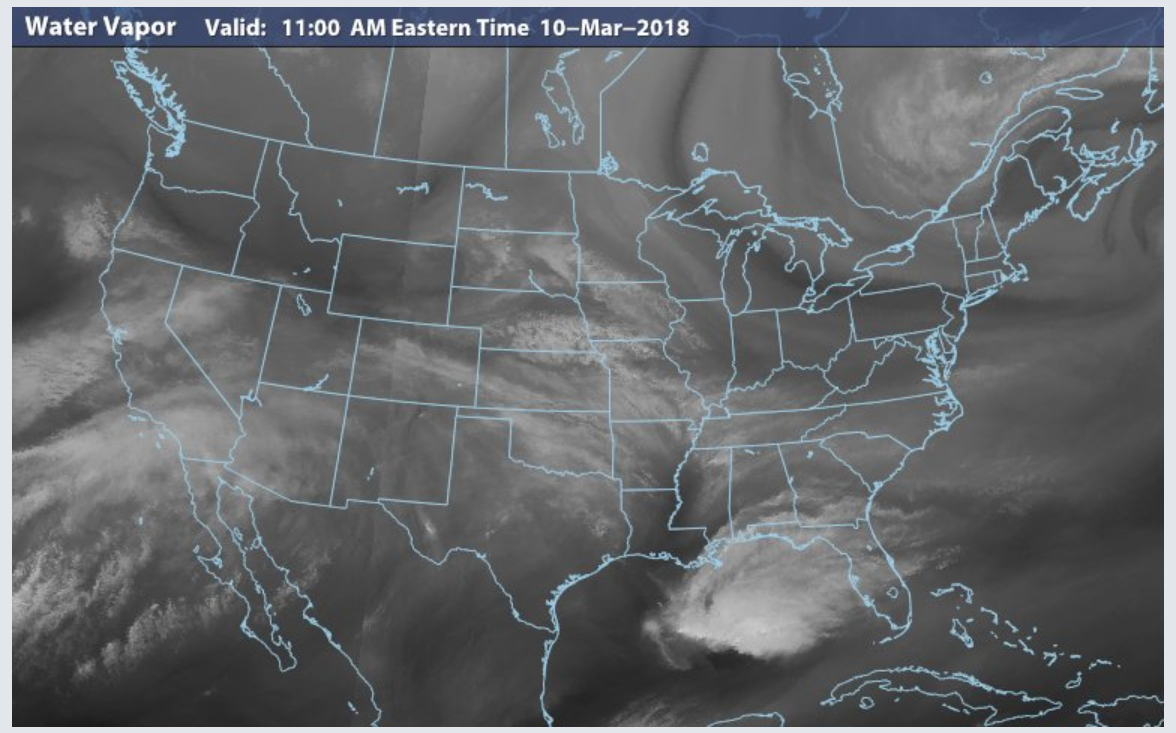
The low pressure front can also be seen on the water vapor satellite image in figure 2.
 |
| Figure 2. Water vapor satellite of the United States. The concentrated water vapor areas are moving from west to east, moving moisture from the Pacific inland. |
And just for fun, the wind map in figure 3 also show the low pressure system.
 |
| Figure 3. Wind map of the United States. The winds over Montana and the Dakotas are subtly moving in a counterclockwise direction, indicative of a low pressure system. |
|
Previous Prediction
The sunny skies I predicted yesterday did not become a reality unfortunately, but I did notice the low pressure systems approaching, so my timing was just off. The temperature is in the ballpark of yesterday as well.
Prediction
It seems that the low pressure systems are not going to be sticking around for long, so tomorrow should be cloudy but warmer due to the low pressure system and early next week it should become sunny again unless another system moves in.


No comments:
Post a Comment