Another Sunny Day
Current Conditions
Temperature: 39 °FDew Point: 23 °F
Winds: 10 mph
Pressure: 1010.8 mb
Visibility: 10 miles
Today was very similar to yesterday. Skies were clear and the temperature reached the high 30s. This morning the temperature was 17 °F with winds SSW at 7 mph. By this afternoon winds had shifted to the west at 10 mph. This wind shift was predicted yesterday with the stationary front moving eastward towards the area. The weather remains uneventful in terms of storms because of the high pressure dome that continues to dominate over the Midwest (figure 1).
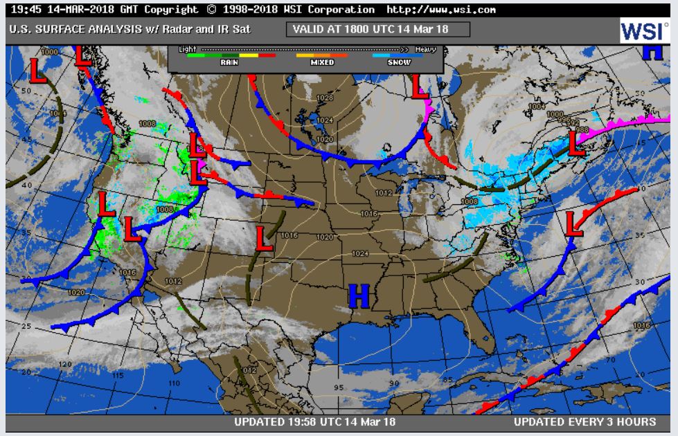 |
| Figure 1. Surface map of the United States. |
 |
| Figure 2. Map showing precipitation amounts in the United States. |
Previous Prediction
My prediction from yesterday was correct. Winds started in the southwest and transitioned to westerly winds which resulted in warmer temperatures today.Prediction
For tomorrow, I predict temperatures similar to today and continuing clear skies due to the high pressure air mass in the area.Also, FYI in addition to being Pi Day, today is also DressForSTEM Day! Everyone is encouraged to wear purple to promote women in STEM fields.
No comments:
Post a Comment