Am I Dreaming?
Current Conditions
Temperature: 42 degrees, feels like 36 degreesDew Point: 30 degrees
Winds: SSW 10 mph
Pressure: 1004.1 mb
Visibility: 10 miles
I asked if I was dreaming today because the high temperature was 48 degrees. Just last week we were in the negatives with wind chill! Wisconsin can be an unpredictable place sometimes. The day started out sunny and foggy with a temperature of 27 degrees and winds out of the south at 7 mph. Towards the afternoon the fog cleared and the temperature rose to the upper 30s with winds slightly increasing to S 10 mph. By the evening the temperature had cooled, but it was still 42 degrees outside. Figure 1 shows the temperatures of the lower 48 states. You can see the polar air pushed back into Canada.
 |
| Figure 1. Temperatures on February 14, 2018 in the contiguous United States. |
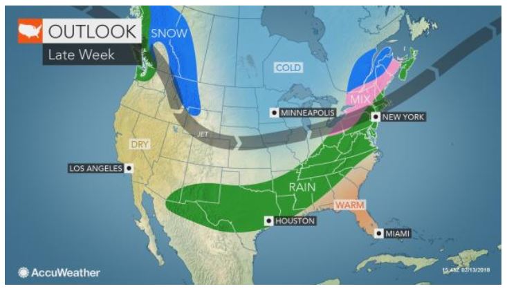 |
| Figure 2. Rain events predicted for next week. |
For tomorrow, temperatures will continue to be warm, but will drop into the 30s due to the low pressure air mass moving farther away from Wisconsin. Figure 3 shows the moving low pressure fronts and the high pressure system from the north bearing down on Wisconsin.
 |
| Figure 3. Map of high and low pressure systems in the United States. |
No comments:
Post a Comment